G'allaorol District
Notable people born here (5 people)
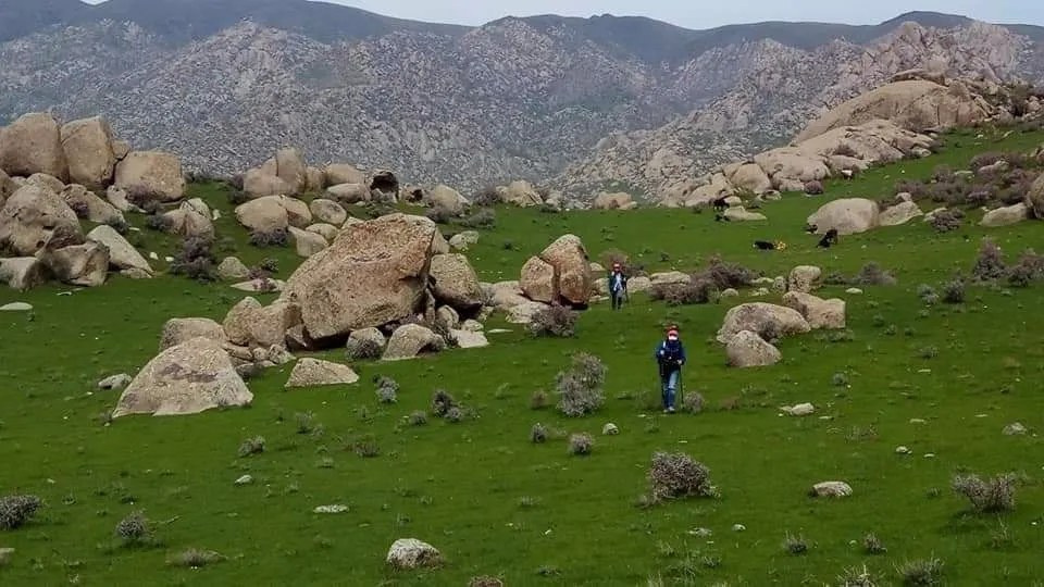
Gʻallaorol District lies in the west of Jizzakh Region, with its centre at the town of Gʻallaorol. It is a grain-growing area between the Nurata and Molguzar mountains.
- Population
- 194,300 (2026)
- Area
- 1,950 km²
- Density
- 100 per km²
- Founded
- 1926
Jizzakh: cities and districts


About the place — G'allaorol District
History
The district was formed on 29 September 1926. In 1943 part of its land went to a new district, which was merged back into Gʻallaorol in 1957.
Geography
The centre and west of the district are plains, while the hills and mountains of the Nurata Range rise in the north and the Molguzar ridge in the east; the Sangzor River crosses the area. Samarkand Region lies to the west. The climate is sharply continental, averaging about −2 °C in January and 32 °C in July, with roughly 330 mm of rain a year. Lead, zinc, gold, granite and building materials are found here. Grain and livestock lead the economy.
Sources: Wikipedia (uz) · Wikipedia (ru) · Wikipedia (en) · gov.uz