Shahrisabz
Notable people born here (3 people)
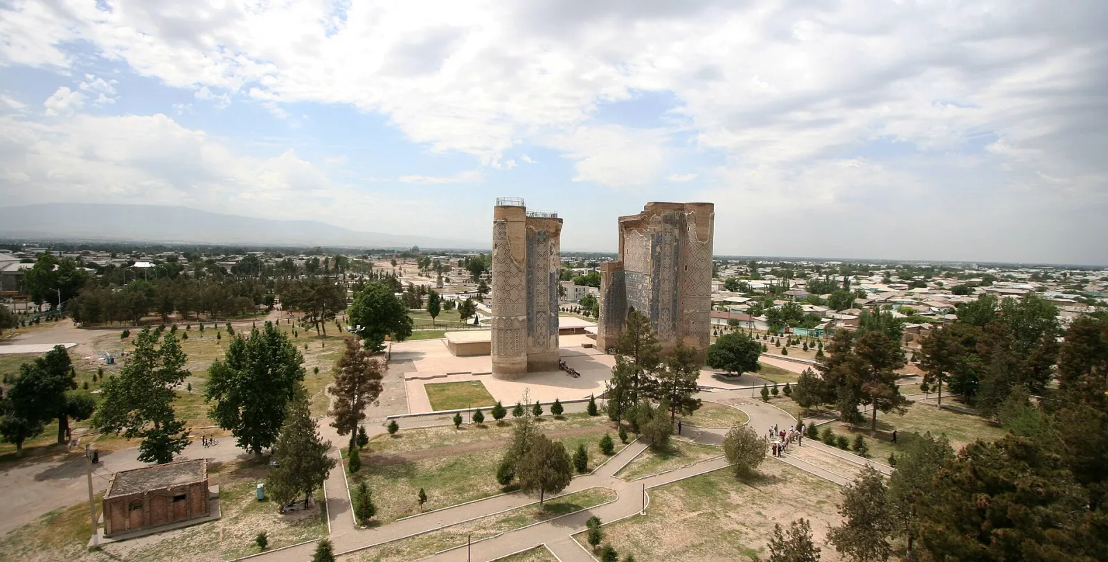
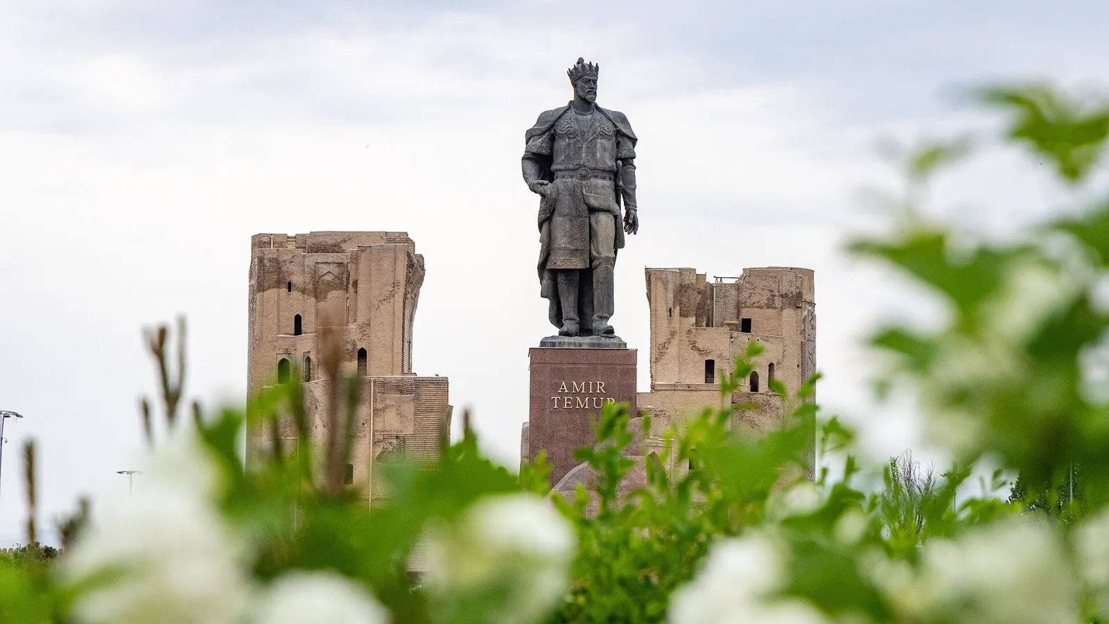
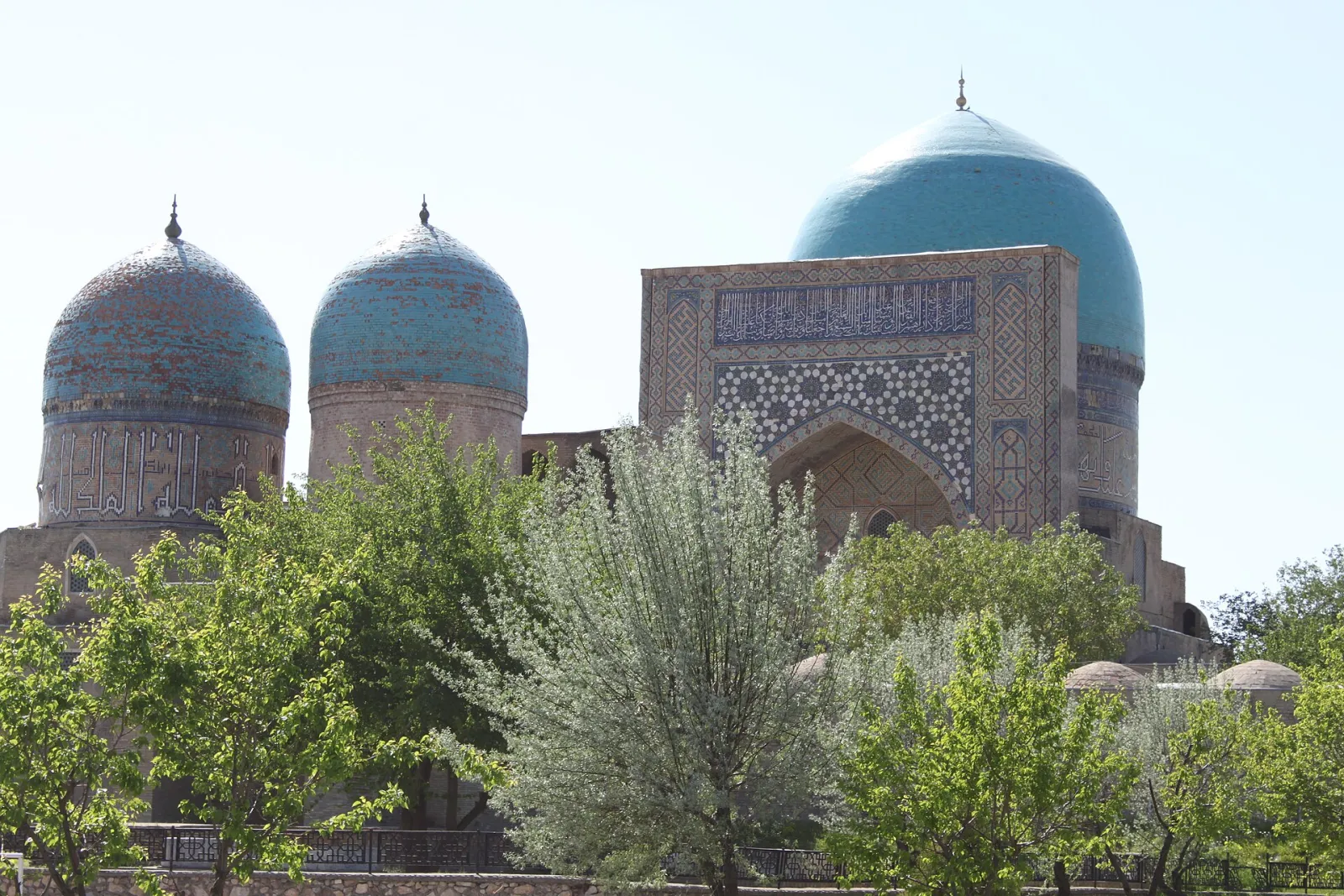
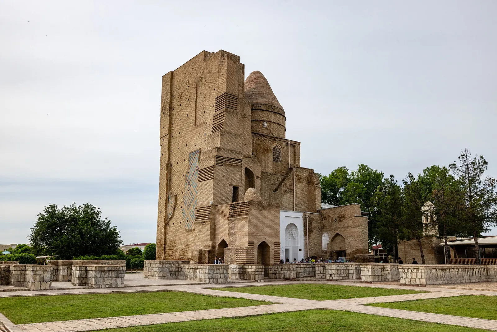
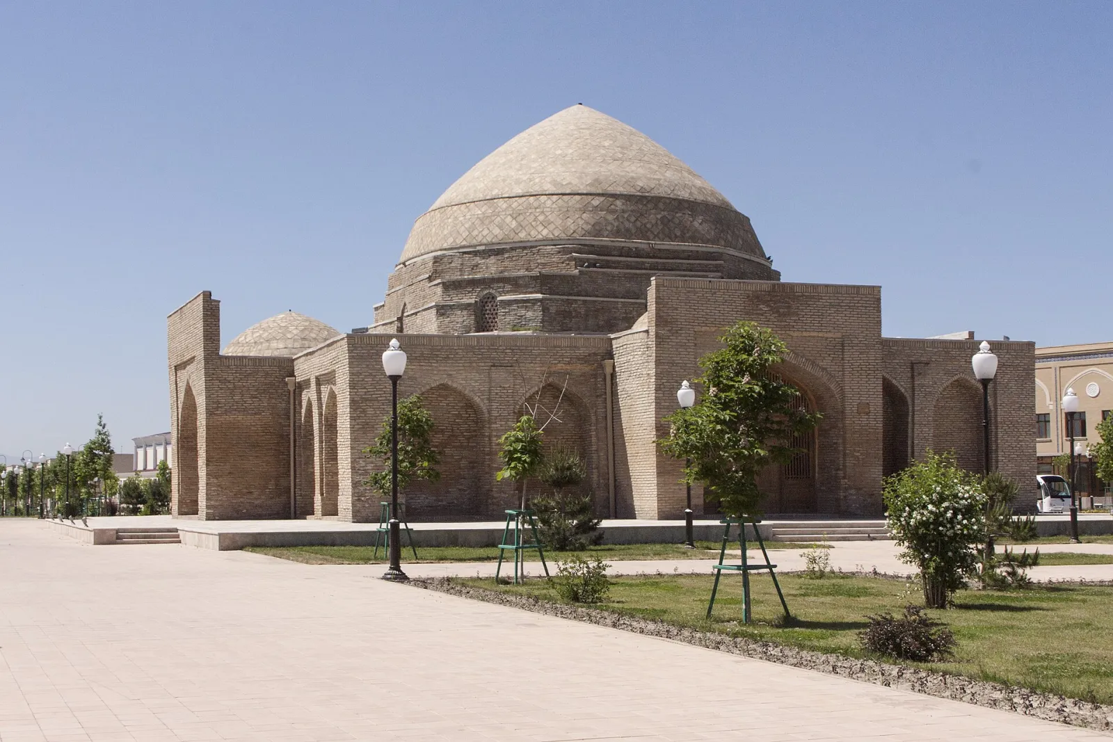
Shahrisabz, known in antiquity as Kesh, is an ancient city in Qashqadaryo Region and the homeland of Amir Temur. Its historic centre, with the Ak-Saray palace and other Timurid buildings, is a UNESCO World Heritage Site.
- Population
- 152,700 (2026)
- Founded
- 1st millennium BC
- Elevation
- 622 m above sea level
Kashkadarya: cities and districts

About the place — Shahrisabz
History
Shahrisabz is one of the oldest cities in Central Asia: archaeology dates its origins to the 1st millennium BC, and its 2,700th anniversary was celebrated in 2002. In antiquity and the early Middle Ages the city, then called Kesh, was an important centre of southern Sogdiana; the armies of Alexander the Great reached the area in the 4th century BC.
In the 6th–7th centuries the rulers of Kesh were subject to the Turkic Khaganate, and in the 8th century the city was taken by the Arabs. In the second half of that century the Kashkadarya oasis became one of the main centres of the "men in white clothes" uprising led by al-Muqanna. Later, urban life shifted a little to the south-west of old Kesh.
Amir Temur was born in 1336 in the village of Khoja Ilgar near Kesh. He held his home town in special regard: from 1380 he built the huge Ak-Saray palace here, and the Dorus-Saodat complex for his eldest son Jahongir. From the 14th century the city was also called Shahrisabz. Under Mirzo Ulugh Beg the Kok Gumbaz congregational mosque was added to the Dorut-Tilovat complex.
From the 16th century Shahrisabz belonged to the Khanate of Bukhara and from the mid-18th century to the Emirate of Bukhara, although its local begs long sought independence from the central power. In 1870 Russian troops took Shahrisabz and Kitob and handed them over to begs appointed by the emir. In Soviet times the city was the centre of Shahrisabz District.
In 1996 Shahrisabz was awarded the Order of Amir Temur, and in 2000 its historic centre was inscribed on the UNESCO World Heritage List. Since 2016 the site has been on the List of World Heritage in Danger because large-scale building work altered its historic setting. The city has had its own administration since 2017, and in 2024 Shahrisabz was the tourism capital of the Economic Cooperation Organization.
Geography
Shahrisabz lies in the north-east of the region, in the Kitob–Shahrisabz oasis, at about 620 m above sea level. The Aksu river runs to the north of the city and the Tankhozdaryo to the south. The Zarafshan range rises to the north, and the road to Samarkand crosses it by the Takhtakaracha pass. The regional centre, Qarshi, is about 90 km to the west.
The climate is continental: summers are long, hot and dry, winters cool, and most precipitation falls in winter and spring. Watered by mountain rivers, the oasis is rich in orchards and vineyards — the city's Persian name itself means "green city".
Sights
- Ak-Saray — the giant portal pylons of Amir Temur's palace, begun in 1380; its arch was once the largest in Central Asia.
- Dorus-Saodat — a complex built for the Timurid family, where the mausoleum of Jahongir and an underground crypt prepared for Temur himself survive.
- Dorut-Tilovat — a complex with the mausoleum of Shamsuddin Kulol, the Gumbazi Sayidon and the Kok Gumbaz mosque built by Ulugh Beg.
- Hazrati Imam Mosque — a mosque next to Dorus-Saodat and a place of pilgrimage.
- Chorsu — a domed trading hall at the crossing of the old market streets.
- Chubin Madrasa — a 16th-century madrasa building.
- Amir Temur monument — erected in 1996 on the square in front of Ak-Saray.
- Museum of History and Material Culture — a museum of the history of the city and the oasis.
Sources: Wikidata · Wikipedia (uz) · Wikipedia (ru) · Wikipedia (en) · api.siat.stat.uz · whc.unesco.org · lex.uz · gov.uz